Upper Yoder, PA
Advertisement
Upper Yoder Township, PA Map
Upper Yoder Township is a US city in Cambria County in the state of Pennsylvania. Located at the longitude and latitude of -78.990590, 40.299420 and situated at an elevation of 560 meters. In the 2020 United States Census, Upper Yoder Township, PA had a population of 5,147 people. Upper Yoder Township is in the Eastern Standard Time timezone at Coordinated Universal Time (UTC) -5. Find directions to Upper Yoder Township, PA, browse local businesses, landmarks, get current traffic estimates, road conditions, and more.
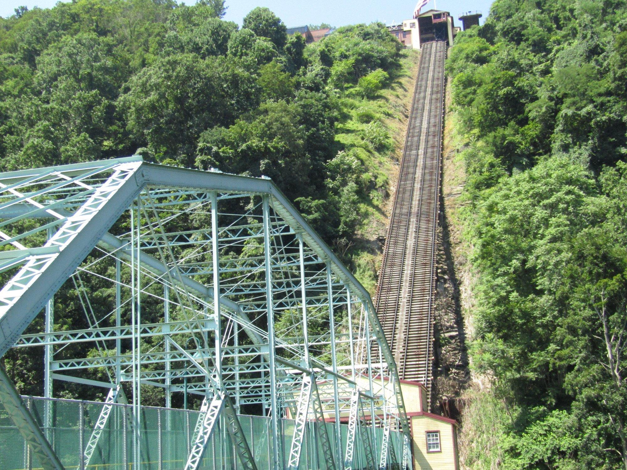
Upper Yoder Township, nestled in the scenic landscapes of Pennsylvania, offers a charming blend of suburban tranquility and historical intrigue. Known for its lush greenery and rolling hills, this township provides a peaceful retreat for those looking to explore the natural beauty of the area. A significant historical highlight includes its proximity to the Johnstown Inclined Plane, which, while technically outside its borders, is a popular nearby attraction. This funicular, one of the steepest in the world, serves as a poignant reminder of the region's industrious past and offers breathtaking views of the surrounding area.
Visitors to Upper Yoder Township can also enjoy a variety of outdoor activities, thanks to its close access to parks and trails that weave through the picturesque countryside. The township itself is dotted with charming residential areas and local eateries that provide a taste of authentic Pennsylvania hospitality. While it may not boast the bustling attractions of a major city, Upper Yoder Township's appeal lies in its serene environment and the rich tapestry of history that blankets the region, making it a worthwhile stop for those seeking a quieter, more reflective travel experience.
Nearby cities include: Westmont, PA, Southmont, PA, Brownstown, PA, Riverside, PA, Ferndale, PA, Johnstown, PA, Dale, PA, Daisytown, PA, Lorain, PA, Belmont, PA.
Places in Upper Yoder
Dine and drink
Eat and drink your way through town.
Can't-miss activities
Culture, natural beauty, and plain old fun.
Places to stay
Hang your (vacation) hat in a place that’s just your style.
Advertisement


